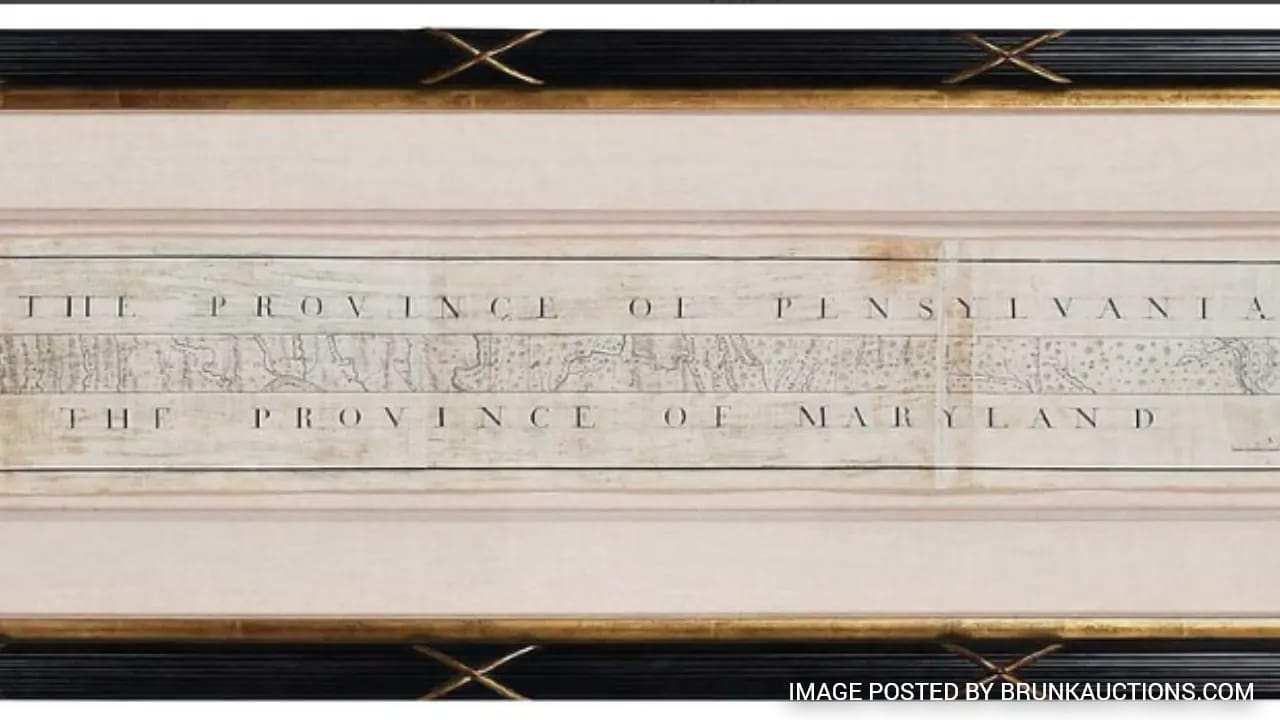
Everyone loves a clean villain and a simple origin story. When an original printing of the 1768 Mason-Dixon Line map hammered down for nearly $1 million at auction, the mainstream press immediately reached for its favorite worn-out cliché. They called it the map that "divided the US into North and South."
It is a tidy headline. It is also completely wrong. For another view, check out: this related article.
Charles Mason and Jeremiah Dixon did not draw a line to split a nation over slavery. In 1763, the United States did not exist. There was no North, no South, and no Mason-Dixon Line acting as a moral boundary between free and slave states. There were just two British colonies—Maryland and Pennsylvania—locked in a bitter, eighty-year real estate dispute over tax revenue and overlapping royal charters.
The auction house hype machine wants you to believe the buyer paid seven figures for the blueprint of the American Civil War. In reality, they paid nearly $1 million for an eighteenth-century property survey that accidentally became a political metaphor decades after its ink dried. Related reporting on this matter has been published by NPR.
The Lazy Consensus of Historical Auctions
Auction houses sell narratives, not paper. When Sotheby’s, Christie’s, or specialized Americana dealers bring a rare cartographic piece to the block, the catalog copy needs to trigger an emotional reflex in high-net-worth bidders. Calling a document "a really accurate 18th-century land survey between the Calvert and Penn families" does not get paddles raised in the seven-figure stratosphere. Calling it "the map that divided America" does.
Mainstream news outlets swallow this framing whole because it requires zero historical heavy lifting. It turns a complex, dry feat of Enlightenment-era geodesy into a digestible soundbite about the Civil War.
I have watched collectors in the rare map and Americana markets burn millions of dollars chasing these manufactured myths. They buy the modern cultural projection attached to an artifact rather than the historical reality of the object itself. When you strip away the nineteenth-century baggage, the 1768 Mason-Dixon map is infinitely more fascinating—and its actual value lies in something the headlines completely ignored.
What Mason and Dixon Actually Did
To understand why the "North vs. South" framing is historically illiterate, you have to look at the ground in 1763.
King Charles I had granted Maryland to the Calvert family in 1632. King Charles II granted Pennsylvania to William Penn in 1681. Because British royal cartographers in the seventeenth century had no idea what the interior of North America actually looked like, those two land grants overlapped. Both families claimed the same fertile strip of territory—including the lucrative port of Philadelphia.
For eighty years, settlers on both sides burned each other's barns, threw tax collectors in jail, and fought border skirmishes like Cresap's War. The British Crown finally forced the Penn and Calvert families to hire two top-tier English surveyors to settle the boundary once and for all.
Enter Charles Mason, an astronomer from the Royal Observatory at Greenwich, and Jeremiah Dixon, a brilliant surveyor from County Durham.
They did not arrive in Philadelphia thinking about abolition, states' rights, or a looming civil war. They arrived with zenith sectors, transit instruments, and six-foot-long wooden measuring rods. Their job was to run a straight line due west along a specific parallel of latitude—39 degrees, 43 minutes north—through dense, unmapped wilderness, swamp, and mountain ridges.
The Geodetic Triumph Nobody Mentions
The real reason that 1768 map is a masterpiece has nothing to do with American sectionalism and everything to do with precision science.
Mason and Dixon used astronomical observations of stars to calculate their exact latitude at every stop. They accounted for the gravitational pull of the Allegheny Mountains, which slightly deflected their plumb bobs and threatened to throw off their vertical readings. Working through brutal winters, thick forest cover, and diplomatic friction with the Haudenosaunee (Iroquois) Confederacy—who forced the expedition to halt at Dunkard Creek in 1767 because the line crossed an ancient warpath—they surveyed 233 miles with an error margin of just a few hundred feet.
By eighteenth-century standards, that level of accuracy was absurd. They placed carved limestone boundary markers imported from England every mile, with every fifth mile featuring a larger "crownstone" bearing the coats of arms of the Penn and Calvert families.
When they finished, they drafted the official plan of the boundary—the exact cartographic achievement that just fetched nearly $1 million. It was a triumph of applied mathematics and British imperial administration. Slavery was entirely legal in both Pennsylvania and Maryland when they packed up their instruments and sailed home to England in 1768.
How a Property Line Became a Political Weapon
So how did a corporate boundary line between two British colonial proprietors morph into the ultimate symbol of American division?
You can blame the Missouri Compromise of 1820.
More than half a century after Mason and Dixon finished their survey, Congress was tearing itself apart over whether to admit Missouri as a slave state. Northern lawmakers needed a clean geographic shorthand to define where slavery ended and free soil began. Pennsylvania had passed its Gradual Abolition Act in 1780, while Maryland remained a slaveholding state.
Politicians in Washington looked at a map, pointed to the straight, familiar border separating Pennsylvania from Maryland, and appropriated the Mason-Dixon Line as the rhetorical boundary between the free North and the slave South.
Once the phrase entered the congressional record during the 1820 debates, newspapers ran with it. Abolitionists used it. Southern fire-eaters used it. By the time Fort Sumter was fired upon in 1861, the original purpose of the survey had been completely erased from public memory. The line had been retrofitted into a prophecy of national fracture.
What Buyers Are Really Asking (And Getting Wrong)
Whenever a historic artifact breaks a price record, the same predictable questions flood search engines and collector forums. Most of them rest on flawed assumptions about value, rarity, and historical significance.
Is the Mason-Dixon map actually rare?
Yes, original 1768 impressions of the Mason-Dixon survey are exceptionally scarce—fewer than a dozen surviving copies are known to exist in institutional and private hands.
However, rarity alone does not drive a $1 million price tag. Thousands of eighteenth-century colonial land surveys are just as rare, and you can buy them at regional auctions for $5,000. The price spike comes from trophy crossover. When an item jumps from the niche "cartography" category into the broader "iconic American history" category, you are no longer competing against map collectors. You are competing against billionaires who want a conversation piece for their library that guests will immediately recognize without needing a history lecture.
Did the map cause the Civil War?
This is the most absurd premise embedded in the coverage. Maps do not cause wars; economic, political, and moral conflicts cause wars.
If Mason and Dixon had failed to finish their survey in 1767, Pennsylvania and Maryland still would have settled on a border, Pennsylvania still would have abolished slavery in 1780, and the cotton economy of the Deep South still would have collided with the industrializing North in the mid-nineteenth century. The map was a ruler, not a catalyst.
Why is it called "Dixie" if Jeremiah Dixon was English?
Here is where the competitor's headline gets particularly sloppy. The nickname "Dixie" for the American South likely has two competing origins, and Jeremiah Dixon is only one of them.
The other—and arguably stronger—etymological root comes from New Orleans. Before the Civil War, the Citizens' Bank of Louisiana printed ten-dollar notes with the French word DIX ("ten") printed prominently on the back. English-speaking traders along the Mississippi River called them "dixies," and New Orleans became known as "Dixieland." Over time, the term expanded to cover the entire Southern region, blending with the folklore surrounding Jeremiah Dixon's survey line. Conflating the 1768 survey directly with the Civil War anthem "Dixie" makes for snappy clickbait, even if it muddles the linguistic history.
The Valuation Trap in Rare Americana
If you are an investor, collector, or curator looking at this nearly $1 million sale as a market benchmark, take a step back before you start writing checks.
There is an undeniable upside to buying myth-driven trophies: liquidity at the ultra-high end. Because the "North vs. South" narrative is baked into American pop culture, a buyer who drops $1 million on a Mason-Dixon map today can probably find another wealthy buyer to take it off their hands in ten years. Cultural shorthand acts as an insurance policy on resale value.
The downside—and it is a massive one—is that narrative premiums are fragile.
When you pay a 400% markup for a modern political myth rather than the intrinsic historical or scientific merit of the object, your investment is tethered to shifting cultural winds. We have already seen this play out across the Americana market. Artifacts tied to Civil War mythology that commanded astronomical prices twenty years ago have either stagnated or become radioactive for institutional buyers and museums.
If you want to build a collection that actually holds intellectual and financial weight over decades, stop chasing headlines and start buying primary pivots.
- Buy the science, not the slogan. Look for documents that represent genuine technological or intellectual breakthroughs—early coastal soundings, pioneering astronomical charts, or first-edition surveys that changed how humans navigated the physical world. Those retain value regardless of how political narratives evolve.
- Audit the provenance, not the catalog essay. Auction houses hire brilliant writers to weave sweeping historical arcs around every lot. Strip out every adjective in the listing. Look strictly at who owned the piece, when it was printed, and what it legally accomplished at the exact moment of its creation.
- Target the unglamorous precursors. Before Mason and Dixon ever set foot in Pennsylvania, colonial surveyors like Joshua Fry and Peter Jefferson (Thomas Jefferson's father) were mapping the Virginia frontier under brutal conditions. Their work laid the foundation for western expansion, yet their maps trade at a fraction of the price because they lack a catchy Civil War nickname.
Stop Buying the Frame Instead of the Picture
The buyer who spent nearly $1 million on the 1768 Mason-Dixon map acquired a stunning piece of eighteenth-century engineering. They own a direct physical link to two brilliant British scientists who dragged heavy brass telescopes through tick-infested swamps to settle a feudal border dispute between two aristocratic English families.
That is a remarkable story on its own. It does not need to be dressed up as the opening act of the Civil War to justify its price tag.
History is messy, technical, and rarely fits on a bumper sticker. Every time an auction house slaps a simplified modern narrative onto a complex historical artifact, they cheapen the actual human achievement sitting inside the frame. The next time a seven-figure historical sale hits the news cycle, read past the headline—because the real value is never in the myth they are selling you.