You can’t fix what you can't measure. It’s a simple truth, but when it comes to the air you breathe, the "measuring" part is way more complicated than most people think. For decades, we relied on a few massive, multi-million dollar stations scattered across cities. These government-run sites are the gold standard, sure, but they’re also blind to what’s happening three blocks away.
Air pollution is local. It’s hyper-local. One street might be clear while the next is a soup of nitrogen dioxide because of a idling delivery truck. If the nearest official sensor is five miles away, that data is basically useless for your daily jog. Meanwhile, you can explore other events here: The Structural Mechanics of Chinese Electric Vehicle Hegemony.
Modern air pollution monitoring is finally moving away from these lonely towers. We're seeing a shift toward distributed networks, satellite eyes, and sensors small enough to fit in your pocket. It’s about density, not just precision. If you want to know how air pollution is being monitored today, you have to look at the layering of three distinct technologies.
The backbone of official data
The Environmental Protection Agency (EPA) in the US and similar bodies like the European Environment Agency rely on Federal Reference Methods (FRM). These are the heavy hitters. We're talking about sensors housed in temperature-controlled trailers that cost as much as a suburban home. To explore the bigger picture, check out the detailed analysis by Engadget.
These stations measure the big offenders: particulate matter (PM2.5 and PM10), ground-level ozone, nitrogen dioxide ($NO_2$), and sulfur dioxide. They use techniques like beta attenuation monitoring or chemiluminescence. They're incredibly accurate. They’re also rare.
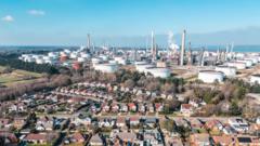
Because they’re so expensive, cities only have a handful. This creates "data deserts." If you live in a low-income neighborhood near an industrial zone, but the station is in a leafy park across town, the official "green" rating on your weather app is a lie. This is why the rise of low-cost sensors matters so much.
The sensor revolution in your neighborhood
The biggest shift in the last five years isn't a new scientific discovery. It's the price drop. You can now buy a PurpleAir or a Plume Labs Flow sensor for a few hundred bucks. These use laser particle counters. A small fan draws in air, a laser hits the particles, and the sensor counts the "bounces" to estimate the mass of dust, soot, or smoke.
Are they as good as the EPA trailers? No. Not even close. High humidity can make these sensors think a water droplet is a piece of soot, which spikes the readings. But quantity has a quality of its own.
When you have 500 cheap sensors in a city instead of two expensive ones, you see patterns. You see the exact moment school buses start their engines. You see how smoke from a kitchen fire drifts through a specific alleyway. Organizations like IQAir aggregate this crowd-sourced data to create real-time maps that are actually relevant to your life.
Why the mix matters
Experts use a "tiered" approach now. They take the rock-solid data from the official stations and use it to calibrate the cheap sensors nearby. It’s a math trick. If the cheap sensor is consistently 10% higher than the EPA station, scientists apply a correction factor across the whole local network. You get the best of both worlds: the accuracy of the big rigs and the coverage of the small ones.
Eyes in the sky
Satellites changed the game for tracking invisible killers like methane and nitrogen dioxide. NASA’s TEMPO (Tropospheric Emissions: Monitoring of Pollution) instrument, launched recently, orbits at a fixed point over North America. It doesn't just take a snapshot once a day. It scans the continent every single hour.
Before TEMPO and the European Sentinel-5P, we had big gaps in our knowledge. Satellites allow us to track plumes of pollution as they cross oceans. We can see how a wildfire in Canada affects the lungs of someone in New York City.
This space-based data is how we catch companies or countries that under-report their emissions. You can hide a faulty sensor on the ground, but you can't hide a massive cloud of $NO_2$ from a satellite. It’s the ultimate accountability tool.
The mobile monitoring experiment
Some of the best data isn't coming from fixed points at all. Google Street View cars have been equipped with Aclima sensors for years. As they drive around to update maps, they’re sniffing the air every second.
This revealed something shocking: air quality can vary by up to 800% within a single city block. A house at the end of a cul-de-sac might have perfectly clean air, while the house at the corner of the main road is basically a tailpipe.
We’re also seeing sensors mounted on city buses and even postal vans. Since these vehicles cover almost every street in a city every day, they create a high-resolution "heat map" of pollution that fixed stations could never dream of.
What we get wrong about the AQI
The Air Quality Index (AQI) is what most people check, but it’s a bit of a blunt instrument. It usually reports the "worst" pollutant of the day. If ozone is high but PM2.5 is low, your AQI reflects the ozone.
The problem? Different pollutants hurt you in different ways. Ozone is an irritant that's worse in the heat of the afternoon. Particulate matter (PM2.5) is small enough to enter your bloodstream and cause long-term heart issues. Monitoring isn't just about a single number from 0 to 500. It’s about knowing which specific chemical is in your space.
Most people check the AQI and think they’re safe if it’s "Yellow." But if you have asthma, even a "Moderate" day with high sulfur dioxide can trigger an attack. We need to stop looking at the one-size-fits-all number and start looking at the specific data points that affect our personal health.
The data is there so use it
If you’re still relying on the evening news for your air quality report, you’re living in the 1990s. The tech has moved on.
Check OpenAQ. It’s an open-source platform that harmonizes data from government and research-grade monitors globally. It’s raw, it’s honest, and it’s not filtered through a PR lens.
If you want to take it a step further, look into the Community Air Monitoring Program (CAMP) initiatives. Many cities now give grants to neighborhoods to install their own sensor grids. This is how communities are fighting back against "environmental racism," proving with hard data that their air is worse than the wealthy suburbs.
Stop assuming the air is fine just because you can't see the smog. Buy a reputable indoor monitor for your home—brands like AirVisual or Awair are solid—to see how your cooking or cleaning products affect your internal environment. Use the AirNow app for official outdoor data, but cross-reference it with PurpleAir to see the street-level truth. Information is the only way to protect your lungs in a world that's still burning far too much fuel.