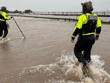
The sirens wail in San Antonio. Dark clouds roll over the Hill Country. A weak, spin-up tornado touches down brief enough to knock over a few patio chairs, and suddenly the media machine goes into overdrive. Heavy rains keep drenching South Texas. Local news channels run live feeds of flooded underpasses, anchors wearing yellow slickers look grave, and the collective panic level rises.
This is the lazy consensus: weather is getting worse, the sky is falling, and we are helpless victims of the latest storm system.
It is a comforting narrative. If we are victims of a freak meteorological anomaly, we do not have to look at the real culprit. But as someone who has spent two decades analyzing municipal infrastructure budgets and urban runoff data, I am here to tell you that the panic over South Texas rain is a massive, expensive distraction.
The problem isn't the rain. The problem is a systematic, profitable failure of concrete, zoning, and intellectual laziness.
The Big Lie of the "Historic" Storm
Every time three inches of rain falls in three hours, municipal PR departments and local news stations scramble to call it a "hundred-year event."
It is a brilliant piece of marketing. If a storm is a once-in-a-century anomaly, how could we possibly expect our engineers to plan for it?
Except it is a lie.
In South Texas, heavy, concentrated downpours are not anomalies. They are the baseline. The region sits directly in the path of moisture plumes from the Gulf of Mexico, colliding with dry continental air masses and the rugged topography of the Balcones Escarpment. This creates a geographic funnel that has produced some of the most intense short-duration rainfall events in North American history.
Look at the data. The infamous 1998 South Texas floods, the 2002 floods, the 2013 Halloween floods, and the 2015 Memorial Day floods. These are not black swan events. They are seasonal schedule items.
When a city like San Antonio or Austin floods from a standard summer convective storm, it is not because the weather was unprecedented. It is because we built cities designed to shed water as fast as possible, directly into the living rooms of the people downstream.
The Concrete Cult and Why More Pipes Won't Save Us
For decades, the engineering establishment has operated under a single, flawed doctrine: collect, concentrate, and convey.
- Collect the rain off roofs and driveways.
- Concentrate it into concrete gutters and storm sewers.
- Convey it as fast as humanly possible to the nearest creek or river.
This is the equivalent of trying to cure a headache by cutting off your head.
By wrapping our cities in an impermeable armor of asphalt and concrete, we prevent the soil from doing its actual job. In a natural South Texas savannah, the clay-heavy soils and native grasses act as a massive sponge. They slow the flow. They absorb the energy.
When you pave over that sponge, you increase the peak runoff volume by up to 800%.
[Natural Ground Cover]  -->  10% Runoff / 90% Absorption & Evaporation
[Paved Urban Center]   -->  55% Runoff / 45% Absorption & Evaporation
Our brilliant solution to this self-inflicted wound? Spend hundreds of millions of taxpayer dollars building massive concrete channels to dump that water into the next county.
I have watched cities spend $50 million on a single drainage channel widening project, only to find that the neighborhood two miles downstream now floods twice as often. We are not solving flooding. We are just exporting it to poorer zip codes.
We do not need bigger pipes. We need to stop paving the Earth.
The False Promise of the 100-Year Floodplain
If you want to buy a house in South Texas, your real estate agent will happily show you a Federal Emergency Management Agency (FEMA) map. They will point to a blue-shaded area and say, "Don't worry, this house is outside the 100-year floodplain. You don't need flood insurance."
This is incredibly dangerous advice.
FEMA maps are backward-looking documents based on historical data that often ignore current development realities. They assume the upstream watershed is static. But while FEMA was drawing that map ten years ago, developers paved over five thousand acres of oak prairie upstream to build three new master-planned communities.
The old map is instantly obsolete.
Furthermore, these maps do not account for localized urban flooding caused by overwhelmed storm drains. In almost every major Texas storm, a significant portion of the damaged homes sit outside the official FEMA floodplain. They flood because the street turned into a river when the local inlets got clogged with trash and grass clippings.
Relying on a FEMA map to determine your flood risk is like using a 1990 road atlas to navigate a brand-new highway system. It is a recipe for getting lost—or in this case, underwater.
The Real Estate Cartel and the Zoning Conspiracy
Why does this cycle continue? Because there is an unholy alliance between municipal tax bases and suburban developers.
Texas cities love growth. Growth means new property taxes and sales tax revenue. Developers want to build cheap, suburban tract housing on cheap land outside the city core. To maximize their margins, they clear-cut native vegetation, scrape away the topsoil, pack the clay subsoil until it is as hard as granite, and build thousands of identical homes with tiny, useless lawns.
To make these developments "safe," the city permits detention ponds—glorified dirt holes designed to hold water temporarily.
But here is the dirty secret: those detention ponds are designed to handle specific, idealized storm models. They do not account for back-to-back storms, where the first storm fills the pond to the brim and the second storm hits twelve hours later. When that happens, the pond overflows, the streets drown, and the developer has already cashed the check and moved on to the next project.
We have privatized the profits of rapid development and socialized the massive, long-term costs of flood infrastructure maintenance.
How to Actually Fix the Texas Flood Problem
Stop waiting for the state or federal government to build a giant dam to save your neighborhood. It is not happening. Instead, we must fundamentally shift our relationship with water.
1. Mandate "No Net Runoff" Development
Every new development, commercial or residential, must be legally required to retain 100% of the runoff generated by a 10-year storm event on-site. No dumping it into the street. No channeling it to the neighbor. If you want to build a 500-home subdivision, you must build the bioswales, rain gardens, and permeable pavements necessary to absorb your own mess.
2. Declare a Moratorium on Balcones Fault Zone Development
The Edward’s Aquifer recharge zone is the most ecologically sensitive and flood-prone area in Texas. Paving over it is municipal suicide. It prevents water from recharging our primary drinking water source and dramatically accelerates downstream flooding. We must treat these areas as untouchable green infrastructure.
3. Rip Up the Turf Grass
The classic Texas suburban lawn—St. Augustine grass kept alive by thousands of gallons of municipal water—is an ecological disaster. Its roots are shallow, and it does almost nothing to absorb heavy rainfall. We need to replace turf with native Texas grasses like Little Bluestem and Sideoats Grama, which have root systems that go feet deep into the earth, creating natural pathways for water to infiltrate the soil.
The next time a tropical disturbance drenches San Antonio, do not look at the sky and curse your luck. Look at the concrete jungle outside your window. The rain is just doing what rain has done for millennia. It is our arrogance, paved in asphalt, that makes it a disaster.