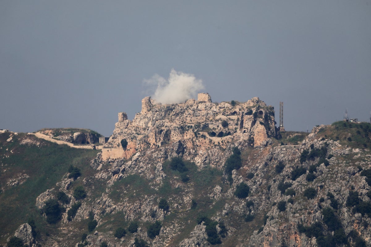
The expansion of Israeli military operations across the United Nations-demarcated Blue Line into southern Lebanon represents a calculated shift from defensive containment to structural terrain transformation. While mainstream media accounts characterize the intense bombardment of the Nabatieh and Tyre regions—including kinetic impacts near the historic Beaufort Castle—as a simple political acceleration by Prime Minister Benjamin Netanyahu, an empirical evaluation reveals a more complex strategic framework. The current military posture is governed by a distinct three-tier operational logic: the establishment of a localized buffer zone, the systematic degradation of Hezbollah's subterranean launch architecture, and the exploitation of high-elevation observation nodes to deny long-range anti-tank guided missile (ATGM) trajectories.
To understand the trajectory of this theater, one must bypass the rhetoric of political intent and isolate the physical, geographic, and electronic variables driving the deployment of force.
The Geopolitical Cost Function and the Yellow Line Failure
The deployment of force in southern Lebanon operates under an underlying friction point: the systemic collapse of the Washington-brokered ceasefire. This framework failed to resolve the core security asymmetry of the northern border. Israel’s strategic cost function is calculated by a simple equation: the political and economic cost of long-term domestic civilian displacement in northern communities versus the kinetic and diplomatic cost of cross-border territorial occupation.
When the nominal security threshold failed to prevent low-altitude explosive drone incursions and high-angle rocket fire, the Israeli military echelon shifted from a policy of proportional retaliation to explicit geographic denial. This led to the expansion of ground maneuvers past the forward defense line into a self-declared security zone. This zone extends five to ten kilometers north of the frontier, bounded by an operational threshold known as the Yellow Line.
[Israel/Lebanon Frontier]
      │
      ├── Blue Line (UN Demarcation Line)
      │     ↓
      ├── Forward Defense Line (Initial IDF positions)
      │     ↓ [5 - 10 km Buffer Zone]
      └── Yellow Line (Expanded Operational Boundary)
            ↓ [New Kinetic Engagement Axis]
            └── Beaufort Castle / Litani River Target Zone
The expansion past this line is not random; it targets specific topographic features. The kinetic strikes recorded near Beaufort Castle (Qalaat al-Shaqif)—a 900-year-old fortification perched atop a 710-meter sheer cliff above the Litani River—highlight this geographic reality. In military topography, Beaufort Castle is a critical observation and signal intelligence asset. It commands an unobstructed line of sight across the entire Nabatieh plateau, the Marjayoun valley, and northern Israel. By directing kinetic strikes to isolate the Zawtar-Shaqif-Khardala triangle, the Israel Defense Forces (IDF) aim to deny Hezbollah the ability to use these high-elevation observation posts for directing mortar and ATGM fire against armored columns maneuvering in the lower valleys.
The Micro-Mechanics of Urban Denial and Structural Demolition
The execution of this expanded ground campaign relies on two simultaneous lines of effort: precision aerial interdiction and systematic structural demolitions.
Precision Air Interdiction and Collateral Air Strike Metrics
The deployment of more than 120 air strikes within a single 24-hour cycle across southern and eastern Lebanon serves a specific shaping function. Rather than acting as general carpet bombing, these strikes target localized infrastructure nodes:
- Logistical Overpasses: Bridging points along the Litani and Zahrani rivers are targeted to restrict the redeployment of Hezbollah’s mobile rocket assets.
- Command and Control Nodes: Targets include subterranean communications facilities and tactical transit tunnels hidden beneath civilian residential zones in Tyre, Saida, and Nabatieh.
- Water and Utility Interdiction: Strikes near the Qaraoun Dam reservoir in the Bekaa Valley highlight an effort to disrupt the logistical sustainability of rural defense sectors.
The human cost of this high-density bombardment is direct. Data from the Lebanese Health Ministry indicates a cumulative casualty threshold exceeding 3,200 fatalities, with localized pulses of high lethality—such as the 14 individuals killed in Burj al-Shamali—correlating precisely with strikes targeting hidden weapon storage facilities. The proximity of these strikes to cultural heritage sites like the ancient quarters of Sour (Tyre) and the Nabatieh courthouse stems from a structural reality: decades of urban integration have placed Hezbollah's tactical launch cells inside historic urban centers.
The Mechanics of the Forced Evacuation Axis
The implementation of mandatory displacement orders north of the Zahrani River acts as a combat space management tool. From a purely functional perspective, clearing the civilian populace achieves two strategic goals:
[Forced Evacuation Order Issued]
               │
               ▼
[Civilian Exodus North of Zahrani River]
               │
               ▼
┌──────────────────────┴──────────────────────┐
▼                                             ▼
[Thermal/Radar Friction Reduction]    [Combat Area Weaponization]
   - Removes non-combatant signatures    - Classifies remaining assets as hostile
   - Accelerates target identification  - Enables systematic structural demolition
Once a village is emptied, the military can use heavy armored bulldozers and combat engineering mines to demolish standing structures along the forward defense line. This creates an artificial field of fire that makes future covert infiltration impossible.
The Hezbollah Defensive Model and Asymmetric Friction
Despite intense aerial interdiction, Hezbollah’s defensive model remains a functional threat to advancing armored units. This capability is driven by an asymmetric friction strategy that avoids direct engagement with main battle tanks. Instead, it relies on two primary weapon profiles: loitering munitions and short-range anti-tank systems.
The limits of total air superiority are visible in the IDF's own casualty data. Of the ten soldiers killed following the collapse of the April truce, sixty percent were killed by low-radar-cross-section explosive drones. These loitering munitions present a distinct air defense challenge:
$$\text{Radar Cross Section (RCS)} \le 0.01,\text{m}^2$$
Because of this tiny signature, they frequently evade standard radar detection loops by flying at low altitudes through mountainous terrain, allowing them to hit stationary military assembly points south of the Litani River.
Simultaneously, Hezbollah utilizes highly dispersed, autonomous cells that operate within pre-positioned subterranean bunkers. These cells utilize individual infantry weapons, mortar tubes, and wire-guided ATGMs. These weapon systems require minimal electronic emissions before launch, neutralizing Western signals intelligence advantages. As Brigadier General Andre Bou Maachar observed, individual tactical weapons can become more influential than ballistic missile stockpiles in close-quarters rural terrain. Ballistic missiles require large, exposed launch platforms that are easily destroyed by air strikes, whereas an isolated infantry team armed with a Kornet-EM ATGM can remain hidden indefinitely in a ruined village, waiting to ambush an advancing column.
Strategic Outlook and Defensive Posturing
The conflict has moved past the phase where a traditional diplomatic ceasefire can restore the status quo ante. The strategic logic dictating Israel’s choices points toward a permanent restructuring of the border geography rather than a temporary political agreement.
The military's next tactical move will likely focus on securing complete physical control over all high-ground terrain south of the Litani River. This will involve establishing hardened, semi-permanent observation outposts along the ridge lines running from Beaufort Castle westward to the coastal cliffs of Tyre. The IDF will continue its policy of structural demolition within the five-kilometer buffer zone, systematically leveling vacant villages to create a permanent, open kill zone that is monitored by automated sensor towers and uncrewed aerial systems.
For Hezbollah, the tactical plan will center on an attrition strategy. They will likely use subterranean tunnels to slip past forward Israeli units, launching short-range explosive drone strikes and mortar barrages to inflict steady casualties on IDF forces. This approach aims to make the long-term occupation of the security zone politically unsustainable for the Israeli government. Consequently, the region south of the Litani River is transitioning into a permanently militarized, depopulated buffer zone. In this environment, raw geographic control and automated surveillance have replaced political agreements as the primary mechanisms for border security.