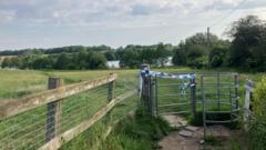
The transition of a missing person case from an active rescue operation to a recovery phase represents a critical shift in public safety logistics, multi-agency coordination, and incident command strategy. When a disappearance occurs at a high-volume natural hazard site—frequently designated as a "beauty spot"—the environmental variables introduce compounding layers of friction that degrade standard search efficiency. Operational data from inland water search and rescue (SAR) deployments indicates that public perception of risk rarely aligns with hydrological reality. This systemic misalignment places immense pressure on local emergency infrastructure, requiring an immediate, structured deployment of specialized assets to minimize the time-to-resolution interval.
Resolving these incidents demands a rigorous understanding of the environmental, mechanical, and logistical frameworks that govern open water searches. By breaking down the operational phases, resource allocation bottlenecks, and preventive structural measures, emergency managers and community stakeholders can better comprehend the execution of high-stakes recovery operations.
The Tri-Phasic Operational Framework of Inland Water SAR
Inland water search and recovery operations do not execute along a linear timeline; instead, they operate within a tri-phasic structural framework dictated by time-delays, survivability curves, and resource availability.
[Phase 1: Rapid Response] ---> [Phase 2: Technical Search] ---> [Phase 3: Recovery Strategy]
  - Immediate Mobilization        - Asset Specialization          - Environmental Transition
  - High Survivability Focus      - Declining Survival Probability - Forensic / Grid Precision
Phase 1: The Rapid Response and Containment Window
The initial zero-to-two-hour window prioritizes rapid intervention and containment. Incident command establishes a localized geographic baseline centered on the Last Seen Point (LSP). Emergency services—including local police units, fire and rescue water rescue teams, and immediate-response ambulance crews—mobilize to secure the perimeter. The primary objective is dual-track: execute immediate shoreline visual sweeps while restricting public access to prevent scene contamination and secondary casualties. Survivability calculations guide this phase, treating the missing individual as viable for rescue until environmental exposure data proves otherwise.
Phase 2: Technical Asset Specialization
When the initial window closes without a positive locating event, the operation shifts from a generalized emergency response to a technical search. The probability of a successful rescue diminishes sharply, forcing a recalculation of asset allocation. This phase introduces specialized external units:
- Underwater Search Units: Police dive teams trained in zero-visibility environments.
- Aerial Surveillance Infrastructure: Drone units equipped with thermal imaging and high-definition optical sensors to map surface anomalies.
- Canine Detection Teams: Specially trained victim recovery dogs capable of detecting scent molecules rising through water columns.
Phase 3: The Transition to Recovery Strategy
The final phase occurs when the timeline surpasses the threshold of human survival in specific water temperatures and conditions. The operational objective pivots from life preservation to forensic recovery. The pace of the operation shifts from urgent to methodical, prioritizing personnel safety and evidence preservation. Incident command restructures the search grid based on hydrological mapping rather than behavioral survival models.
Hydrological Mechanics and Geographic Friction Factors
The location of an incident significantly dictates the efficacy of technical search assets. Natural beauty spots—such as reservoirs, disused quarries, rivers, and deep lakes—present distinct physical properties that actively obstruct standard search methodologies.
The Thermal and Depth Profile of Inland Reservoirs
Reservoirs and deep lakes do not maintain a uniform temperature. They suffer from thermal stratification, creating distinct layers separated by a thermocline. Surface waters may appear warm and calm, masking a rapid drop in temperature just meters below.
This temperature differential triggers immediate physiological reactions in untrained swimmers, primarily cold water shock. This response induces involuntary gasping, hyperventilation, and cardiac stress, leading to rapid submersion within minutes of entry. For search teams, the cold water preserves organic matter, altering the expected timeline for natural buoyancy changes and extending the duration of underwater grid searches.
Underwater Topography and Submerged Hazards
Unlike controlled swimming environments, natural bodies of water feature highly unpredictable floor topographies. Disused quarries and reservoirs frequently contain submerged industrial infrastructure, sharp rock shelves, dense aquatic vegetation, and sheer drop-offs.
| Water Body Type | Primary Hydrological Hazard | Search Asset Limitation |
|---|---|---|
| Inland Reservoirs | Thermal stratification, sudden drop-offs | Silt disturbance blinding dive teams |
| Disused Quarries | Submerged machinery, sheer vertical walls | Sonar signal fragmentation |
| Tidal/Flowing Rivers | Moving currents, debris accumulation | Variable Last Seen Point (LSP) drift |
These structural hazards introduce significant risks for public safety divers. Silt and fine sediment on the bed can be disturbed by a single fin stroke, reducing visibility to absolute zero instantly. Consequently, dive teams must rely on tactile search methodologies, moving centimeter by centimeter along a physical guide line, which exponentially increases the time required to clear a standard grid sector.
The Logistical Friction of Multi-Agency Coordination
A primary vulnerability in complex SAR operations is the communication and logistical bottleneck that occurs when multiple independent agencies converge on a single incident command post. Efficient resolution requires a unified command structure to manage distinct organizational cultures and operational mandates.
                  [Unified Incident Command]
                              |
       +----------------------+----------------------+
       |                      |                      |
[Police Infrastructure] [Fire & Rescue Units]  [Volunteer SAR Assets]
   - Legal Jurisdiction    - Immediate Extraction - Localized Expertise
   - Scene Custody         - Technical Craft      - High-Density Manpower
Establishing Legal and Operational Jurisdiction
Police forces maintain overall custody of missing person investigations, treating the site simultaneously as a search zone and a potential crime scene until proven otherwise. Fire and rescue services provide the physical infrastructure for water extraction and immediate technical rescue craft. Volunteer search associations (such as lowland or mountain rescue teams) supply high-density manpower and localized geographical expertise.
Friction develops when data sharing protocols fail. If the police command unit utilizes digital mapping software incompatible with the telemetry systems used by air support or volunteer teams, search grids can overlap or leave uninspected gaps. Mitigating this risk requires strict adherence to standardized incident management frameworks, ensuring a single, centralized log dictates asset positioning.
Managing Information Asymmetry and Public Infiltration
In the modern information ecosystem, high-profile search operations quickly attract digital and physical onlookers. Crowdsourcing search efforts via social media frequently introduces severe operational interference. Well-meaning members of the public or independent digital content creators can compromise the physical perimeter, inadvertently destroying track evidence along the shoreline or placing themselves in hazardous positions.
Furthermore, speculative dissemination of unverified information online forces the police infrastructure to divert analytical resources away from core search metrics to manage public relations and counter misinformation. Managing the perimeter requires a dedicated law enforcement contingent independent of the search teams.
Preventative Infrastructure and Risk Mitigation Frameworks
Addressing the systemic frequency of accidental drownings at inland waterways requires moving beyond reactive operational excellence to proactive structural engineering and behavioral modification.
Engineering Out the Hazard
The most effective method for reducing water-related fatalities involves physical modification of access points. Relying on signage alone is insufficient; cognitive bias often leads individuals to underestimate risks when confronted with a visually appealing environment.
- Physical Perimeters: Installing high-tensile fencing around high-risk zones like quarry rims and reservoir intake structures.
- Public Rescue Equipment (PRE): Strategically placing throw lines and lifebuoys equipped with electronic tamper alarms that alert local emergency services when deployed.
- Egress Infrastructure: Creating deliberate, high-visibility exit points or shallow shelving areas along urbanized or high-traffic shorelines to allow individuals who fall in accidentally to climb out without assistance.
Data-Driven Public Awareness Integration
Public safety campaigns must shift away from generalized warnings toward highly specific, mechanism-based education. Highlighting the precise physiological impacts of cold water shock and the hidden mechanical dangers of underwater currents provides potential visitors with a realistic risk assessment framework. Targeting educational initiatives at the demographic groups statistically overrepresented in accidental drowning data—primarily young males—ensures resource allocation yields maximum preventative impact.
Optimizing Search Protocols Through Technological Integration
To counter the inherent limitations of human diver endurance and visibility constraints, modern recovery operations must increasingly leverage advanced technological systems. The deployment of Side-Scan Sonar (SSS) and Remotely Operated Vehicles (ROVs) transforms the speed and safety profile of underwater searches.
Side-scan sonar systems emit acoustic pulses to create highly detailed, photo-like images of the water floor, independent of water clarity. By towing a sonar transducer behind a surface craft, search teams can map large underwater areas in a fraction of the time required by a dive team. When the sonar identifies a high-probability anomaly, incident command can deploy an ROV equipped with high-definition cameras and robotic manipulators to investigate the target.
This sequence preserves human diver capacity for confirmation and recovery actions rather than exploratory searches, reducing overall operational risk exposure. The limitation shifts from environmental visibility to data interpretation accuracy, requiring specialized analysts on-site to differentiate between submerged debris and target signatures.
The strategic imperative for emergency services involves the standardization of these technical assets across regional boundaries. Ensuring that localized dive teams possess immediate access to automated underwater scanning technology eliminates the delay associated with requesting mutual aid from distant jurisdictions. Reducing the time elapsed between the initial incident report and the deployment of advanced mapping assets remains the most critical variable in optimizing recovery timelines and ensuring personnel safety.