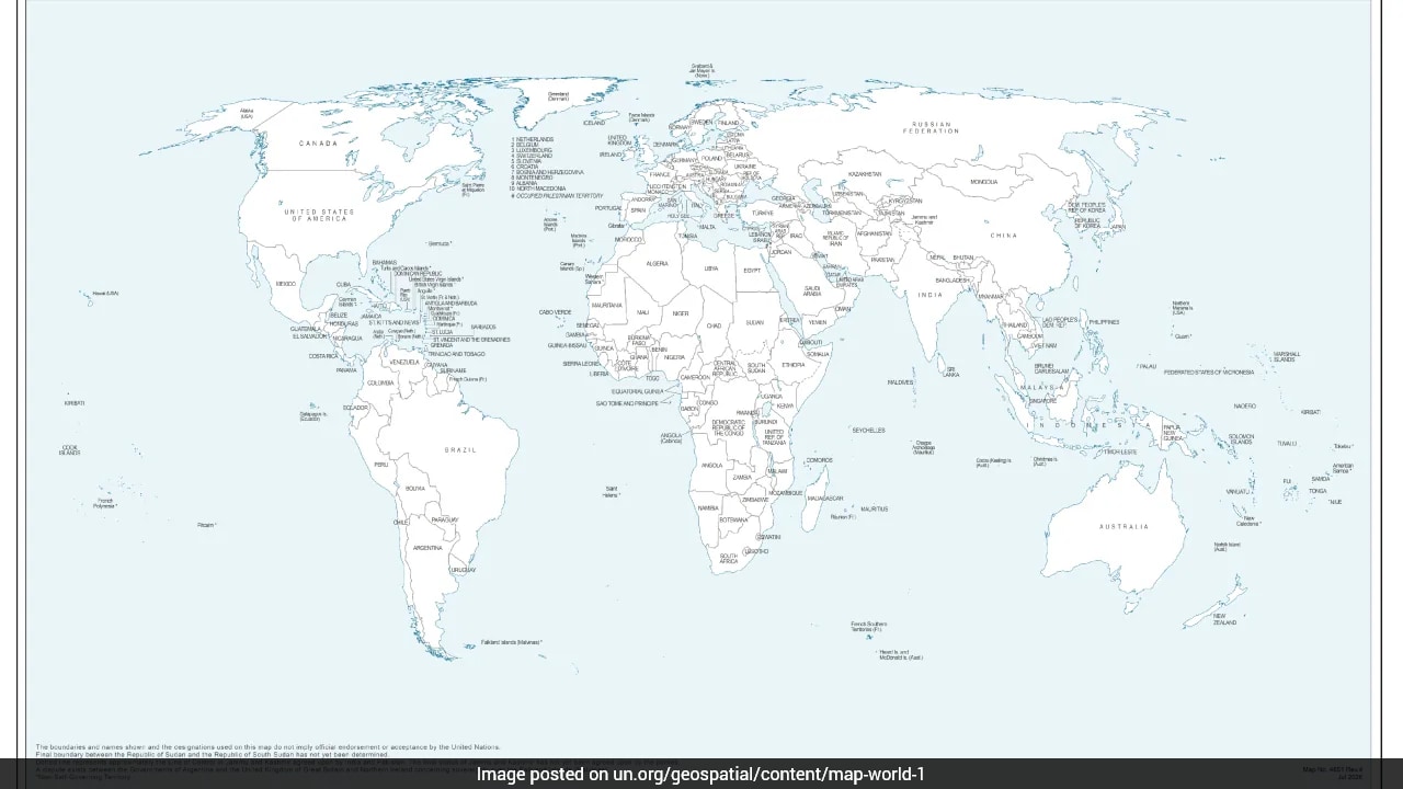
International cartography rarely stays quiet for long, especially when global bodies mess with sensitive borders. New Delhi just found itself forced to clarify its diplomatic stance after a newly released United Nations world map chose to depict Arunachal Pradesh and Aksai Chin as separate regions trapped between rival claim lines.
If you look closely at how the international community handles disputed territories, you realize mistakes or subtle changes carry massive political weight. The Ministry of External Affairs didn't waste time addressing the issue. They made sure everyone understood that voting for a broader global resolution doesn't mean endorsing sloppy map-making.
What the UN Map Actually Shows
The controversial world map first surfaced on July 1, but it grabbed headlines only after the United Nations General Assembly adopted an African Union-backed resolution titled "Correct the Map" on September 4. That resolution aimed to fix disproportionate representations of continental landmasses.
Instead of keeping standard national boundaries intact, the UN's graphic department produced rendering anomalies:
- Arunachal Pradesh is detached from its traditional boundary with Nagaland, floating as a separate entity bordered by Assam and China.
- Aksai Chin is isolated as a distinct region sitting directly between Indian and Chinese claim lines.
- Jammu and Kashmir features a distinct dotted Line of Control with an explicit footnote stating its final status remains unresolved.
The UN offered zero official explanations for altering these regional borders. Cartographic shifts of this scale never happen by accident. They always spark immediate diplomatic friction.
Why India Voted Yes and Where New Delhi Draws the Line
People often assume that supporting a UN resolution means signing off on every graphic attached to it. India's vote in favor of the "Correct the Map" initiative was strictly about promoting equal-area cartographic representation—ensuring landmass sizes scale fairly without hidden agendas.
MEA spokesperson Randhir Jaiswal pointed out that supporting a framework for equal-area maps does not equal approval of any private party or entity's distorted boundaries.
India's stance remains absolute and non-negotiable:
- Sovereign territory must match official Indian maps down to the last millimeter.
- Depicting Arunachal Pradesh or Aksai Chin as disputed zones between claim lines is entirely unacceptable.
- Technical voting at the UN for generalized global reforms will never override core territorial integrity.
The Real Cost of Cartographic Controversies
Global bodies like the UN walk a tightrope between administrative neutrality and geopolitical reality. When international organizations publish maps that bracket Indian territories into ambiguous zones, it hands rival nations a propaganda talking point.
New Delhi's swift pushback serves a clear purpose. If you stay silent on minor map adjustments today, those anomalies turn into established precedents tomorrow. India's reaction proves that territorial sovereignty isn't just about boots on the ground. It's fiercely defended on paper, on screens, and inside every international assembly hall.


