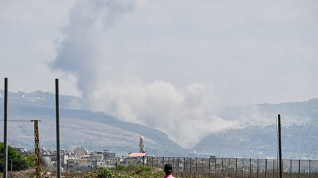
The fire in California's Big Sur region doubled in size overnight, transforming a manageable timber flare-up into an aggressive, unpredictable front that is currently forcing emergency evacuations along the iconic Highway 1 corridor. When a wildfire scales up by one hundred percent in a single dark cycle, suppression tactics must shift instantly from offensive containment to chaotic triage. Embers do not care about scenic vistas or multi-million-dollar coastal properties. They ride erratic ridge-line winds across steep canyons, jumping firebreaks that crews spent hours carving into brittle chaparral.
Understanding why these coastal conflagrations accelerate with such terrifying speed requires looking past standard meteorological reports. Big Sur is not just a postcard landscape. It is a vertical wilderness defined by inaccessible terrain, ancient redwoods, and an accumulation of dead fuel born from years of cyclical drought. When marine layers fail to push inland, humidity plummets, and the dense underbrush dries out until it behaves like kindling left next to an open furnace.
The Anatomy of Overnight Expansion
Fire behavior changes dramatically after sunset. Daytime winds often calm down, leading civilian observers to assume the danger has subsided. Yet seasoned strike team leaders know that nocturnal downslope winds can reverse this assumption with brutal efficiency. Gravity pulls cold air off the high Santa Lucia peaks, dragging super-heated air masses down narrow canyons.
This phenomenon turns every ravine into a natural wind tunnel. As the flames funnel downward, they pre-heat the vegetation ahead of the main front through radiant heat transfer. By the time the actual flame front arrives, the brush is already primed to combust explosively. That is how a blaze doubles in geographic footprint while most residents are asleep miles away.
Emergency responders face severe operational constraints in this terrain. Ground crews cannot simply walk up a forty-degree slope choked with fallen timber and thick poison oak in the dead of night. They rely on handlines, controlled burns, and aerial support. But smoke and turbulence frequently ground helicopters and fixed-wing air tankers during the most critical hours of overnight growth.
Evacuation Logistics on a Single Lifeline
Highway 1 is the primary escape route for residents, tourists, and seasonal workers strung along the rugged coastline. It is also a notoriously fragile ribbon of asphalt susceptible to landslides, winter washouts, and now, wall-to-wall fire. When mandatory evacuation orders drop, a mass exodus funnels onto a two-lane highway flanked by vertical rock faces on one side and sheer drops into the Pacific Ocean on the other.
Traffic bottlenecks form quickly. A single disabled vehicle or a stalled trailer can trap dozens of evacuees behind a wall of advancing smoke. Local sheriff deputies and California Highway Patrol officers face the impossible task of managing gridlock while actively pushing people away from active flame fronts.
- Mandatory zones expand hourly as wind directions shift without warning.
- Temporary evacuation points fill up at community centers outside the immediate danger radius.
- Communication towers lose power, plunging remote coastal pockets into digital isolation.
For those who choose to stay behind to protect their homes with garden hoses and portable generators, the danger multiplies. First responders prioritize life safety above all else. If a homeowner refuses to evacuate, rescue crews may not be able to return for them when conditions deteriorate past the threshold of survivability.
The Broader Ecological Reality
Every major fire event in Big Sur writes a new chapter in a long-standing ecological debate. Decades of aggressive fire suppression policies have left these forests choked with abnormal amounts of combustible material. Nature eventually clears the ledger. When a high-intensity fire sweeps through an ecosystem adapted to low-intensity burns, the ecological damage can outstrip natural recovery timelines.
Soil hydrophobic layers form when extreme heat bakes organic compounds into the dirt. When the winter rainy season finally arrives, this baked earth cannot absorb water. Mudslides and debris flows routinely follow major wildfires, threatening the very coastal communities that survived the flames.
Resource managers walk a razor-thin edge. Prescribed burns are necessary to reduce fuel loads, but escaping control lines can trigger public outrage and political fallout. Funding for brush clearance often lags far behind what is required to manage thousands of acres of private and public wildlands.
The smoke plume from the current Big Sur fire continues to drift northward, blanketing neighboring counties in a hazy pall that grounds flights and triggers air quality alerts. Emergency shelters remain at capacity. Strike teams from across the state are rotating onto the lines, grabbing brief hours of sleep on cots in high school gymnasiums before heading back into the ash and heat. The fire is still moving.