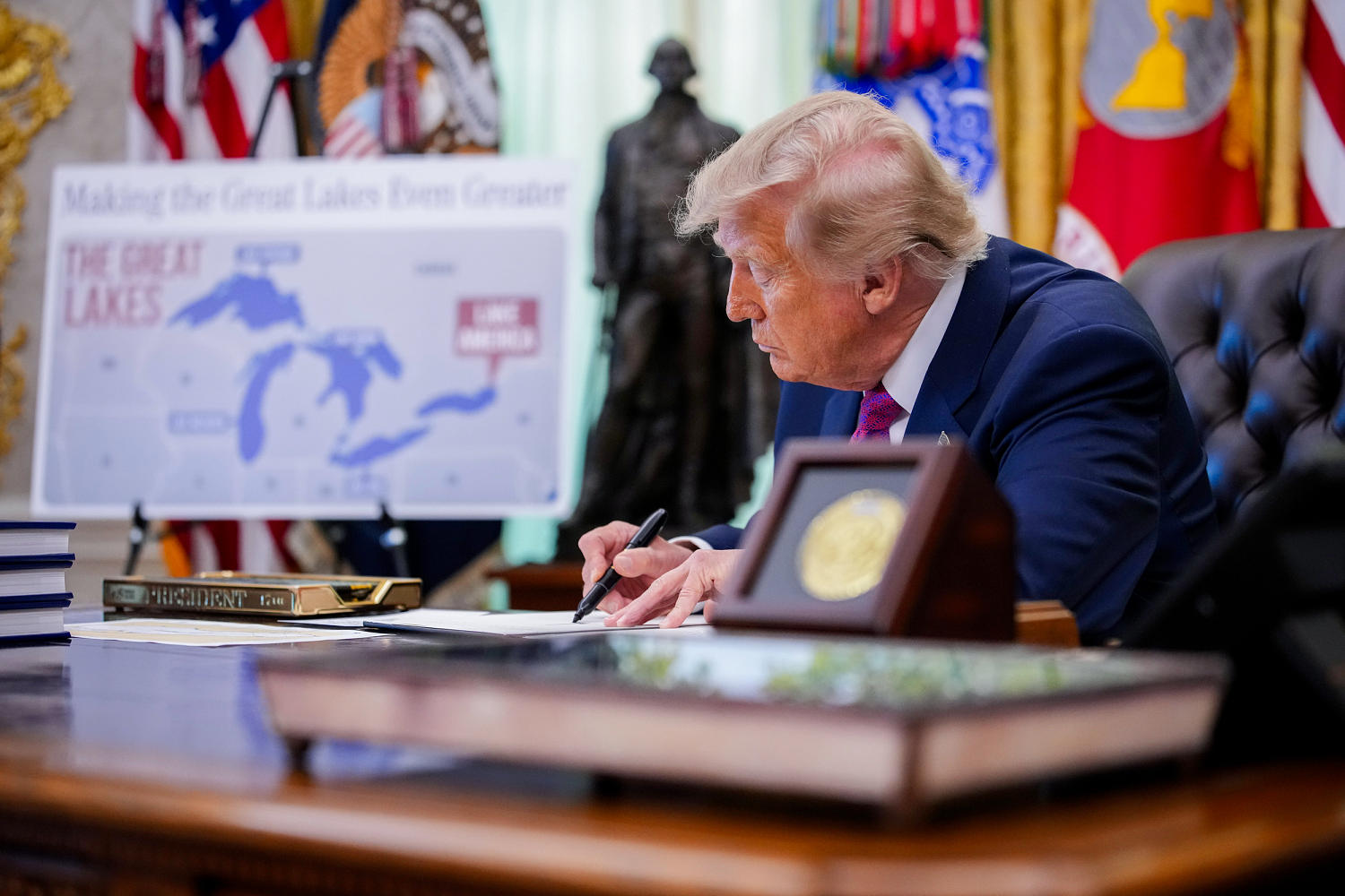
Geographic nomenclature is rarely neutral, functioning instead as an artifact of sovereignty, historical compromise, and administrative convention. When executive power is directed toward altering established cartographic markers, the action operates less as a physical intervention and more as an exercise in signaling within a broader economic dispute. The recent directive targeting the designation of Lake Ontario within United States federal databases illustrates how administrative instruments are deployed to exert psychological and economic leverage during bilateral negotiations. Evaluating this maneuver requires looking past the rhetorical surface to examine the structural limits of domestic executive authority over shared transnational assets.
The administrative mechanism relies entirely on internal jurisdictional control. Under United States constitutional and statutory frameworks, the executive branch possesses broad authority to dictate how federal agencies, domestic mapping services, and internal databases reference geographic features. The Department of the Interior, through the Board on Geographic Names and the Geographic Names Information System, maintains standardized nomenclature for official use. Directing these entities to adopt a new designation alters federal documents, internal maps, and administrative communication channels without requiring congressional statute. Expanding on this idea, you can also read: Inside the Middle East Quagmire Nobody is Daring to Name.
However, jurisdictional boundaries impose an absolute ceiling on the efficacy of such directives. Transnational bodies of water governed by international borders do not fall under unilateral municipal control. While domestic agencies can be compelled to update internal software and printed publications, the administrative mandate terminates at the international water boundary. Ottawa retains full sovereign authority over its territorial waters, lakebed allocation, and provincial cartography. Canadian officials, provincial premiers, and municipal leaders maintain the existing designation across all Canadian public and private infrastructure, rendering the executive order an exercise in domestic administrative realignment rather than a binational change.
The economic context driving this cartographic shift involves systemic trade friction and structural deficits. Bilateral negotiations between Washington and Ottawa regarding steel, aluminum, lumber, and dairy quotas recently collapsed after months of intensive discourse. The administration utilized the threat and execution of steep tariffs alongside symbolic naming adjustments to increase pressure during trade standoffs. Economic analysts note that bilateral trade imbalances are heavily skewed by specific sector exchanges, particularly energy imports. By deploying non-tariff tools such as executive naming orders, the executive branch attempts to alter the psychological framing of trade negotiations, signaling dissatisfaction to domestic constituencies while raising the political cost of stalemate for the northern neighbor. Observers at Reuters have provided expertise on this situation.
International law and cartographic standards provide no mechanism for a single nation to alter shared geographic identifiers on global maps. Global hydrographic bodies, international shipping registries, and foreign mapping publishers rely on consensus and historical precedent. Organizations such as the International Hydrographic Organization operate on multilateral agreement, ensuring that shared features retain recognized designations regardless of municipal executive orders issued by one participating state. Consequently, private sector mapmakers and international navigation systems continue to utilize the standard nomenclature to maintain operational consistency across borders.
The strategic utility of domestic hydrographic renaming is therefore confined to domestic signaling and administrative friction. When trade talks deadlock, administrative tools outside traditional commerce channels are frequently mobilized to sustain political momentum. The long-term consequence of these actions is structural divergence between domestic federal databases and international standards, creating friction for geographic information systems that must reconcile conflicting institutional datasets without altering physical reality.
Analyze the structural impact of regional trade retaliation metrics on cross-border supply chain efficiency by examining tariff implementation timelines and logistics data.
Trump signs executive order renaming Lake Ontario to Lake America
This video provides direct footage and primary coverage of the White House announcement regarding the executive order on Lake Ontario.
http://googleusercontent.com/youtube_content/1