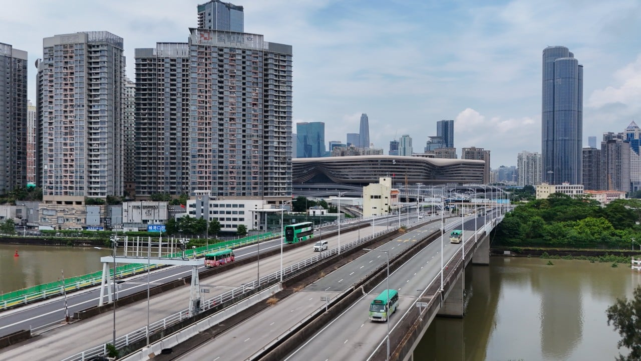
The redevelopment of the Huanggang border crossing represents a fundamental redesign of regional transit mechanics between Hong Kong and Shenzhen. Previous iterations of the checkpoint suffered from high spatial friction, redundant administrative layers, and structural separation between jurisdictions. The rebuilt multi-story facility addresses these historical bottlenecks by introducing a compressed spatial model and a unified processing mechanism designed to eliminate redundant passenger movements. Understanding how this transition alters cross-border transit requires evaluating the underlying structural mechanics of capacity, clearance speed, and urban integration.
The Mechanics of Co Location and Single Queue Processing
Traditional land border crossings operate on a sequential exit-and-entry model. Travelers clear jurisdiction A, transition through a physical buffer zone, and queue again to clear jurisdiction B. This dual-stop architecture introduces a compounding queue delay, where the throughput of the entire system is bound to the slower of the two independent inspection points.
The redeveloped Huanggang facility resolves this structural inefficiency through a collaborative inspection and joint clearance protocol. Under this framework, authorities from both Shenzhen and Hong Kong operate within a shared operational footprint governed by a co-location arrangement. Travelers join a single queue rather than two distinct lines.
The automated channel architecture relies on a three-tier gate sequence:
- Document Verification: The first gate reads the travel credential and validates baseline eligibility.
- Biometric Capture: The second gate executes facial and fingerprint capture to match the credential holder against national databases.
- Jurisdictional Release: The third gate finalizes exit and entry clearance simultaneously.
By collapsing two independent administrative interactions into a single physical passage, the operational friction drops substantially. Processing times shift from a historical baseline of roughly thirty minutes down to approximately five minutes per passenger.
Capacity Scaling and the Transit Integration Variable
Infrastructure design must account for peak load distribution and intermodal connectivity to prevent internal congestion from spilling outward. The Huanggang project manages this through a vertical stacking strategy that separates pedestrian flows, vehicular transit, and rail connections across distinct structural levels.
The baseline operational capacity is engineered to handle 200,000 passenger trips per day. However, throughput capacity is structurally linked to the broader regional rail network. The design incorporates provisions for the future MTR Northern Link Spur Line, which will connect directly into the multi-story checkpoint building. Once this rail integration is active, the daily design capacity scales upward to 300,000 passenger trips.
To evaluate the capacity metrics objectively, consider the following structural variables:
- Initial Daily Design Load: 200,000 passenger trips.
- Expanded Daily Capacity: 300,000 passenger trips post-rail commissioning.
- Automated Infrastructure: 134 electronic channels supported by 68 staffed counters.
- Vehicular Allocation: Approximately 15,000 cross-boundary vehicular trips daily.
This configuration eliminates cargo inspection functions from the Huanggang site, shifting freight entirely to alternative crossings. By removing heavy commercial vehicle processing from the footprint, the facility dedicates its entire spatial and electrical capacity—including 32 main transformers supplying substantial power—to passenger and light transit throughput.
Spatial Compression and Urban Restructuring
A major driver of the Huanggang reconstruction is land-use efficiency. The original surface-level checkpoint occupied a sprawling footprint exceeding 500,000 square meters, primarily dedicated to sprawling surface parking, vehicle inspection bays, and low-density administrative structures.
The redeveloped vertical terminal reduces the direct operational footprint to approximately 75,000 square meters. This spatial compression releases roughly 400,000 square meters of prime urban land within the Futian district. This reclaimed acreage is systematically integrated into the Shenzhen Park of the Shenzhen-Hong Kong Science and Technology Innovation Cooperation Zone.
The architectural pivot transforms the border from a hard administrative barrier into a high-density transit-oriented development hub. By stacking customs facilities, public transport interchanges, and pedestrian pathways across vertical tiers, the physical interface between the two cities behaves more like an internal urban interchange than an international boundary.
Deploy cross-border transit strategies that assume zero dwell time at the physical threshold; configure logistics and commuter schedules around the five-minute processing benchmark while accounting for post-commissioning volume surges upon the activation of the Northern Link Spur Line.