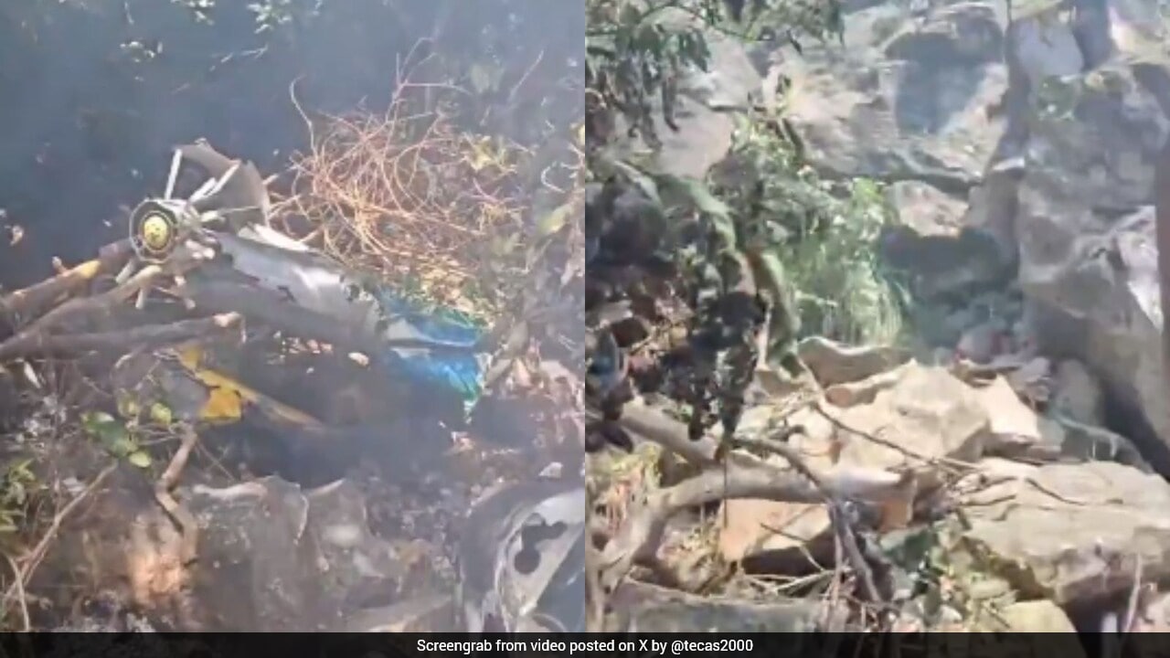
Low-altitude scenic aviation in remote topography exposes passengers to compound operational hazards that traditional risk matrices fail to capture. When a Eurocopter EC130 B4 operating a charter flight for high-end safari tourists crashed near Mount Ololokwe in Samburu County, Kenya, killing all seven occupants, public discourse defaulted to superficial tragedy narratives. A forensic look past the headlines reveals an urgent operational reality: the structural intersection of complex microclimates, high-density single-engine utility flying, and regulatory oversight deficits in East African bush aviation.
The Operational Risk Architecture of East African Safari Charters
Commercial bush flying relies on visual flight rules operating inside volatile topographical corridors. Northern Kenya presents a distinct set of environmental variables that drastically compress pilot decision-making margins.
- Topographical Venturi Effects: Mountainous monoliths like Mount Ololokwe create localized wind shear, rapid downdrafts, and unpredictable thermal columns that challenge rotary-wing stability during low-altitude wildlife tracking or scenic transitions.
- Infrastructure Isolation: Remote conservancies such as Loisaba lack radar coverage, automated weather observing systems, and high-frequency communication relays, forcing reliance on decentralized satellite messaging and visual confirmation.
- Payload and Performance Tradeoffs: Single-engine turbine helicopters optimized for sightseeing configurations frequently operate near maximum gross weight thresholds during multi-day luxury itineraries, altering autorotation profiles and power reserve margins.
[Environmental Volatility (Thermal/Wind Shear)]
       │
       ▼
[Compressed Decision-Making Margins] ──► [Single-Engine High-Density Load] ──► [Critical Incident Probability]
       ▲
       │
[Infrastructural Isolation (No Radar/AWOS)]
The Human Factor and Fleet Vulnerability Matrix
The systemic vulnerabilities within remote charter logistics extend beyond meteorology into fleet composition and regulatory enforcement. The aircraft involved—the Eurocopter EC130 B4—is an industry standard for tourism due to its wide cabin and excellent external visibility. However, heavy commercial utilization rates in harsh environments accelerate mechanical fatigue if maintenance tracking lacks absolute rigor.
The second tier of vulnerability lies in operational scheduling pressure. High-yield tourism models incentivize high daily asset utilization. When charter operators balance tight client transfer windows across dispersed conservancies against erratic weather windows, cognitive load on flight crews spikes. In an environment where the margin between safe terrain clearance and structural impact is measured in seconds, operational tempo acts as a silent safety hazard.
Regulatory Oversight and the Multi-Agency Response Bottleneck
The immediate aftermath of a remote bush crash exposes systemic limitations in localized search and rescue architecture. Because accidents occur in rugged terrain devoid of terrestrial access roads, initial response times depend entirely on secondary air assets dispatched by rival operators, as demonstrated by the deployment of backup helicopters from neighboring safari firms.
The regulatory body, the Kenya Civil Aviation Authority, faces structural hurdles in executing continuous flight-tracking enforcement across decentralized airstrips and private conservancies. Without mandatory flight data monitoring and strict adherence to proactive safety management systems, independent charter operators carry the dual burden of self-regulation and execution under extreme environmental constraints.
Strategic Operational Mandates for Regional Charter Safety
Mitigating catastrophic loss in remote tourism aviation requires an immediate pivot from reactive investigation to preventative systems engineering.
- Mandatory Flight Data Monitoring: Implement lightweight, cellular- or satellite-enabled flight tracking and parameter recording on all commercial tourist charters to capture real-time telemetry before structural failures occur.
- Terrain Awareness Technology Integration: Mandate low-altitude radar altimeters and advanced terrain awareness warning systems specifically calibrated for regional topographical anomalies.
- Standardized Microclimate Protocol: Establish strict meteorological dispatch thresholds that eliminate pilot discretion during visual transitions through known high-wind mountain passes.
- Consolidated Emergency Response Pools: Formalize cross-operator rescue frameworks to institutionalize immediate resource pooling rather than relying on ad-hoc inter-company dispatch during critical golden-hour windows.
Rigorous safety upgrades across East Africa's bush aviation sector must decouple asset utilization rates from pilot dispatch authority, insulating front-line flight crews from commercial pressures inherent to high-end safari logistics.